Helping you capture precise real-world data so you can improve efficiency in your construction, restoration, or infrastructure project.
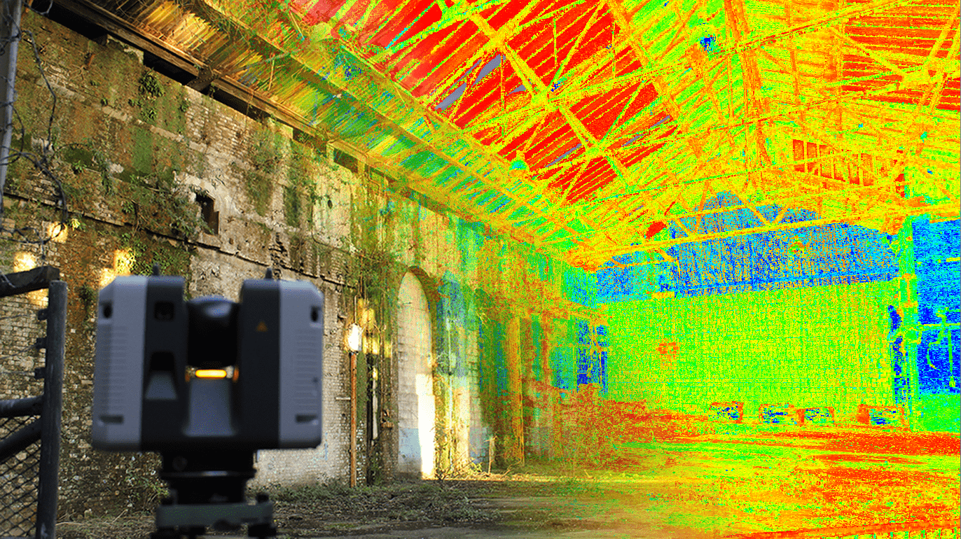
High-definition laser scanning capturing detailed data.
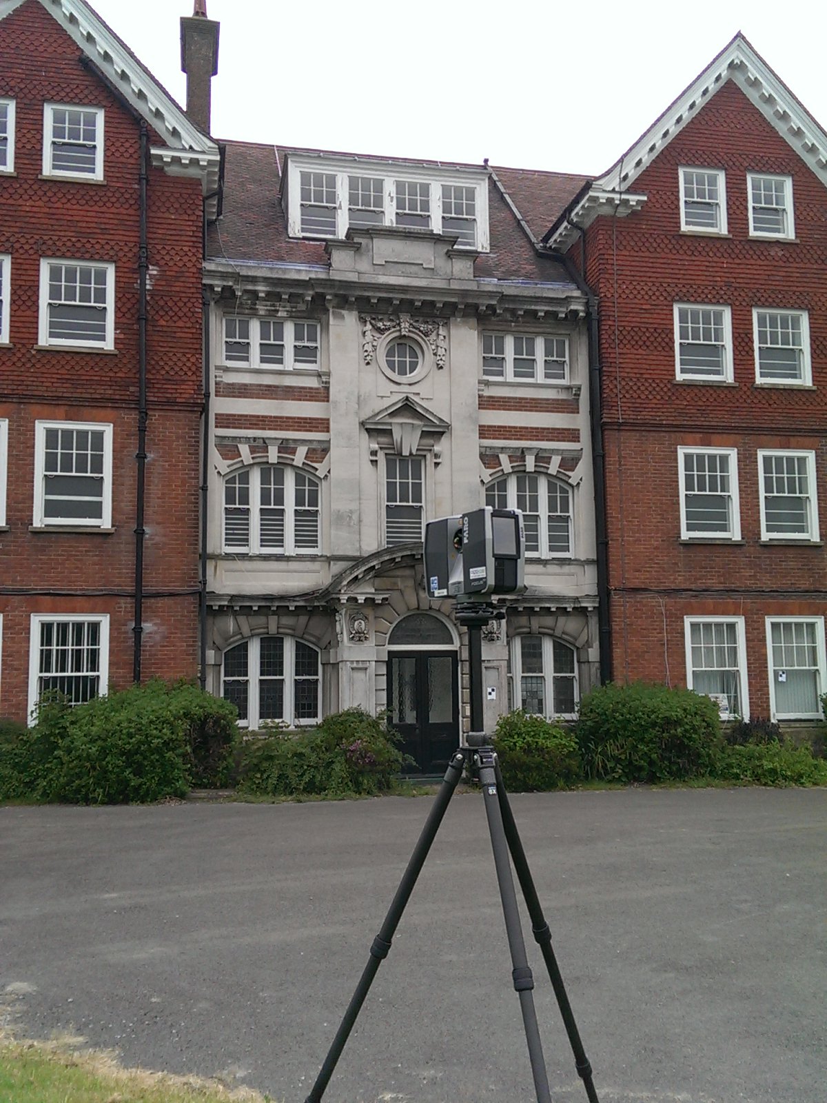
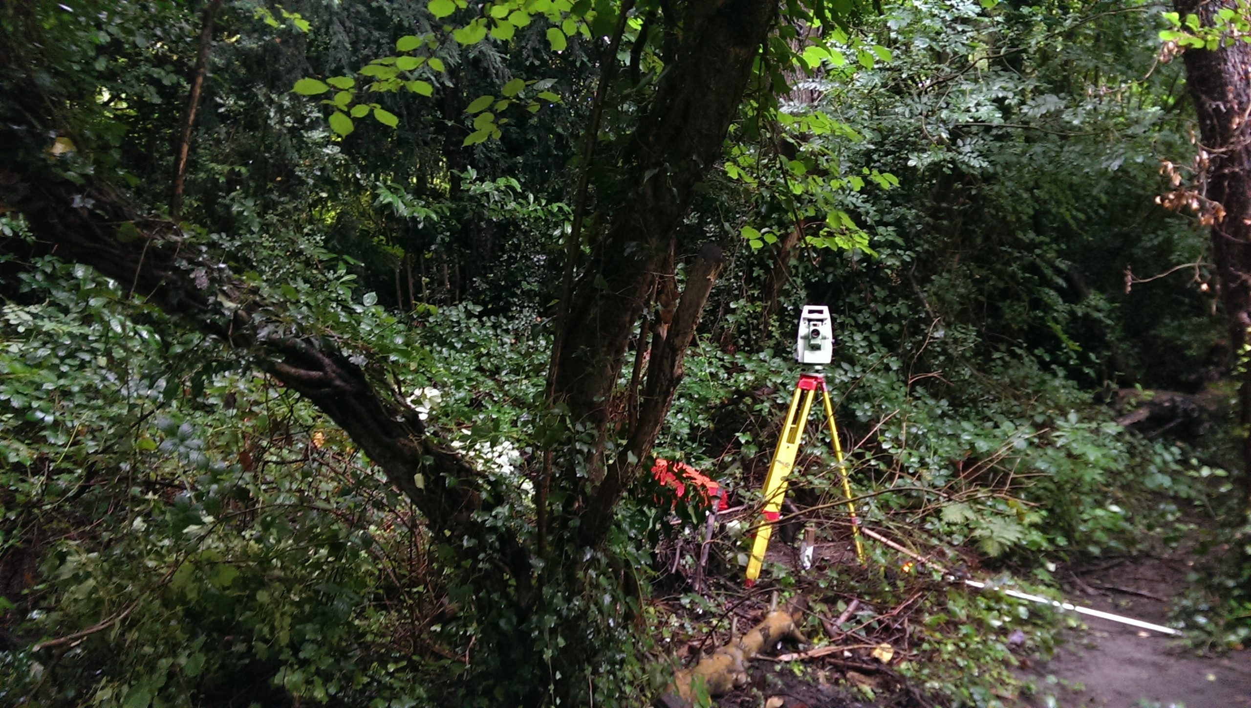
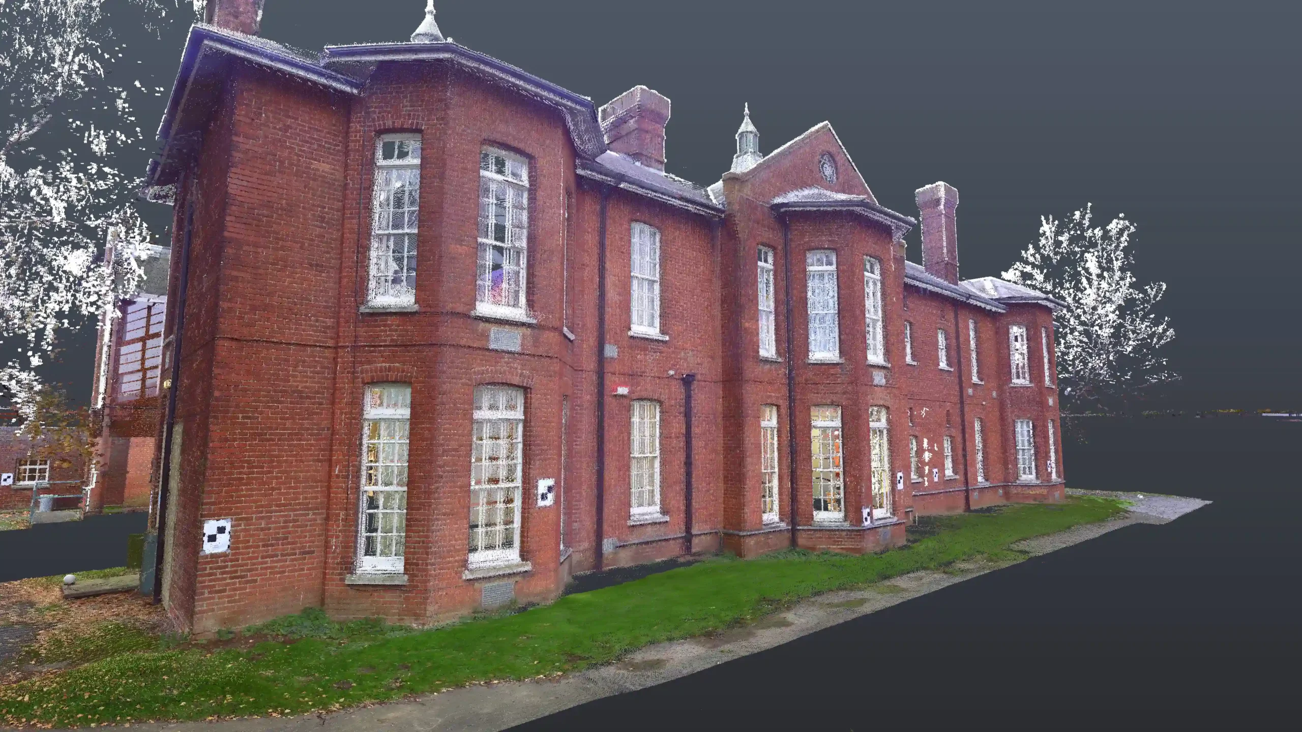
Laser scanning captures accurate site information and measurements, providing essential information to help assess and model structures for construction or restoration.
What is HD Laser Scanning?
HD Laser Scanning is a technology that captures precise 3D measurements and detailed site data, which helps you to model structures or environments for construction, restoration, or infrastructure projects. By providing accurate, real-world data quickly, you can reduce errors and improve your planning process.
Our team uses advanced laser scanners to capture data and create point clouds, which can be turned into 3D models. This data can be used for detailed drawings, early-stage visualisation, and improving project efficiency.
When do you need HD Laser Scanning?
Highly accurate site data is crucial when you’re working on complex construction, restoration, or infrastructure projects. Without accurate site measurements, your team could unknowingly design a structure that doesn’t fit the existing environment. Utility lines might conflict with new foundations, or existing walls might be in the wrong place, requiring expensive adjustments or even re-building sections.
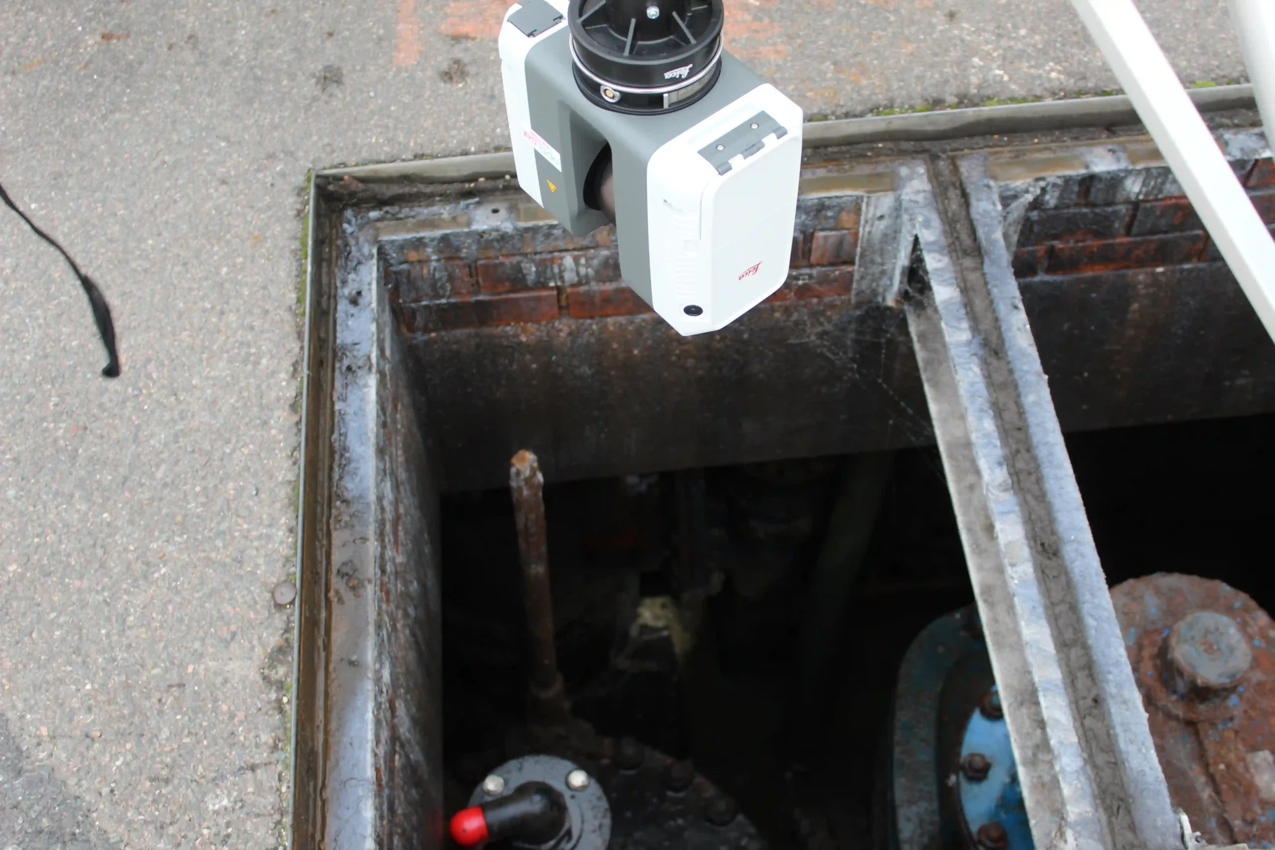
Our HD Laser Scanning will give you precise 3D measurements, detailed point clouds and fully intelligent 3D models that can be used for safe and accurate project visualisation. HD Laser Scanning also allows you to survey hard-to-reach areas, like manholes and tight plant room spaces, without the need for manual entry.
How does HD Laser Scanning work with SDS?
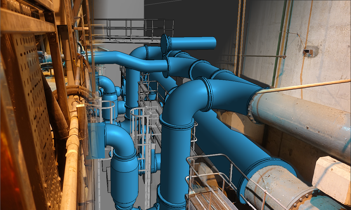
We use cutting-edge HD Laser Scanning technology that captures billions of data points with unmatched precision, creating fully intelligent 3D models that bring your project to life. This technology gives you real-time, accurate insights into site conditions, allowing you to visualise every detail.
The point clouds captured through laser scanning can be seamlessly integrated into your Building Information Modeling (BIM) system. This allows you to create detailed 3D models with intelligent objects that can be enriched with data from various contractors, making it easier to coordinate and collaborate across teams.
By incorporating laser scanning into your BIM process, you can ensure that your designs are based on the most accurate, up-to-date information.
Start a conversation with us today
Get a HD Laser Scanning survey estimate by contacting our friendly team today.
- Surveying since 1988
- Simple enquiry form
- Experienced team
Get SDS in for HD Laser Scanning
At SDS, we’re a long-standing, dedicated surveying business, delivering our services to private and public sectors across Kent and beyond. We specialise in HD laser scanning, helping construction, restoration, and infrastructure teams with accurate site measurements and 3D models more efficient project planning.
Whether you’re designing a new building or assessing an existing structure, we provide precise data to inform confident design decisions.
Contact our team today for more information about our surveying services or to book your HD Laser Scanning.