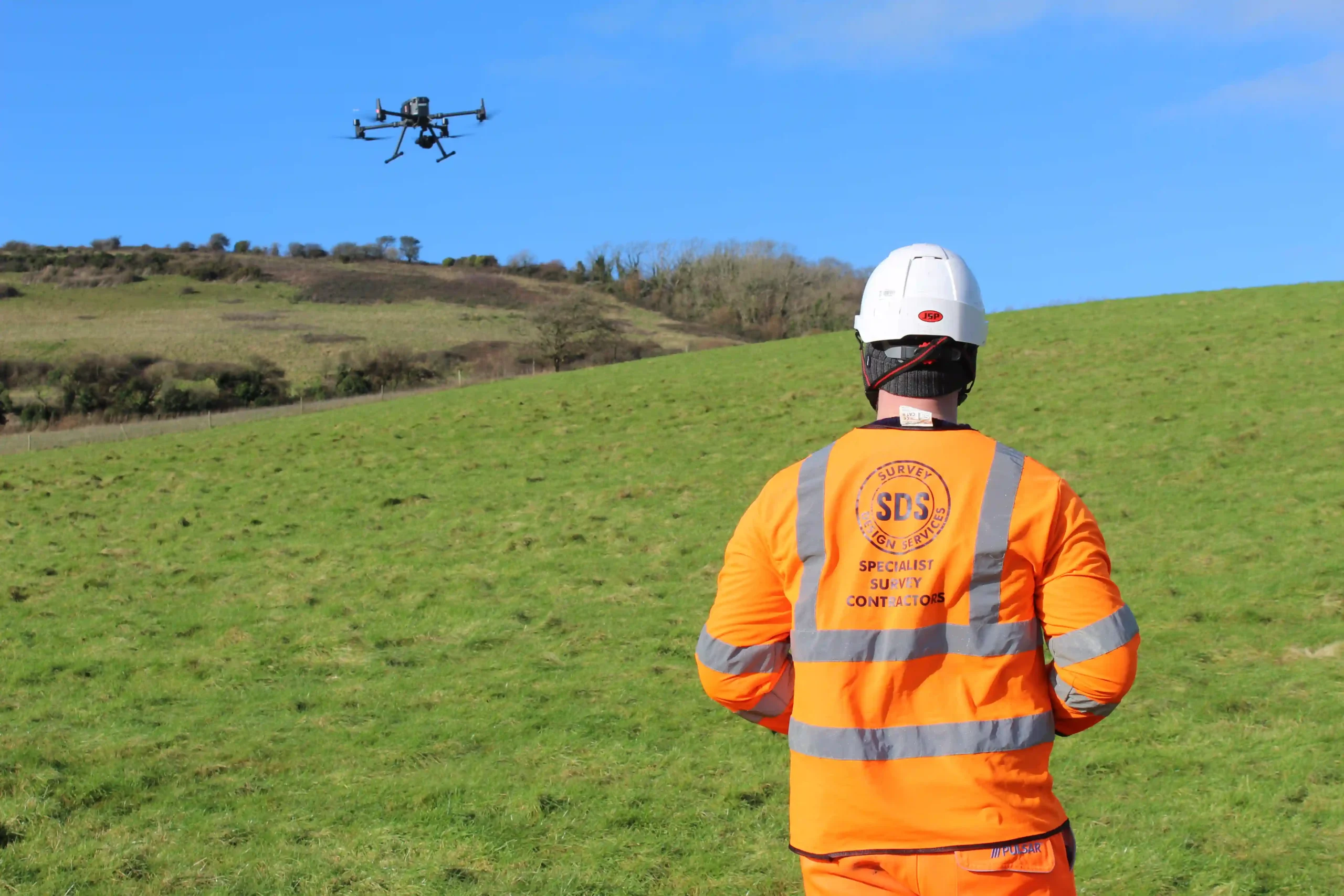
Helping you gather precise topographical data and visual inspections from hard-to-reach areas.
Get true-to-scale high-resolution maps and models
We use unmanned aerial vehicles to capture georeferenced, high-resolution aerial photos for true-to-scale maps and models.
Our drone surveys capture detailed aerial data, providing precise maps and 3D models to enhance site analysis.
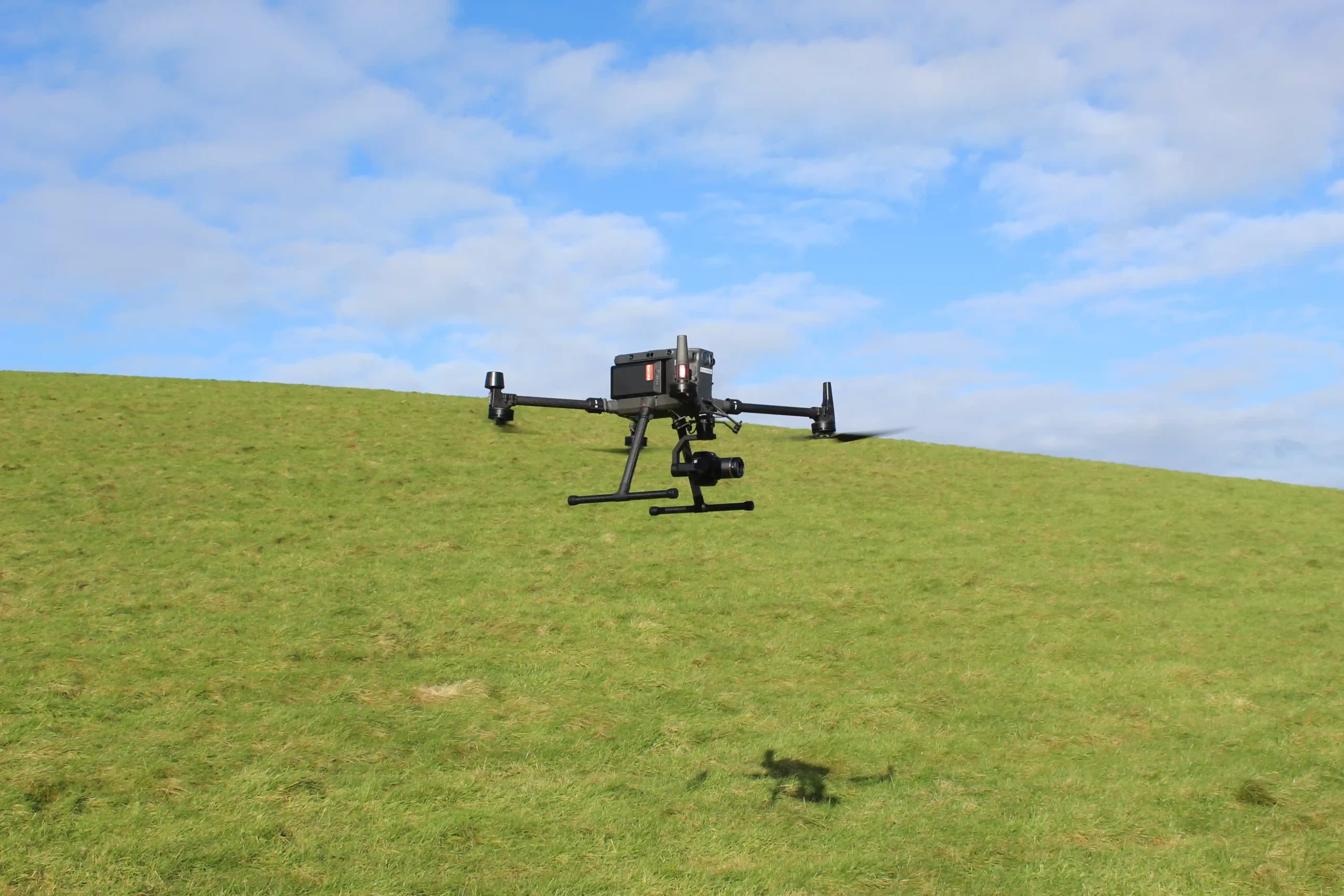
What are UAV / Drone Surveys?
UAV / Drone Surveys are advanced aerial surveys using unmanned aerial vehicles (UAVs) equipped with high-resolution cameras and sensors. These help you quickly gather detailed data from hard-to-reach areas such as:
- Remote or rugged terrain
- Construction sites with limited space or ongoing operations
- High-rise buildings, rooftops, towers or bridges
- Flood or disaster-stricken areas
- Dense vegetation
By obtaining georeferenced aerial photos, point clouds, and 3D models, you’ll improve project accuracy and reduce fieldwork time and costs.
UAV surveys offer a cost-efficient solution by minimising time spent on-site while still delivering high-quality data. The data captured through UAV surveys can be used for topographical mapping, site monitoring, 3D modelling, building inspections, urban planning, and many more insights across industries.
When do you need UAV / Drone Surveys?
Up-to-date data is essential during the initial planning and site assessment phase of a construction, environmental, or development project. These surveys are particularly valuable in situations where access is limited, dangerous, or costly for traditional survey methods. This ensures both safety and efficiency from the very start of a project.
Our UAV / Drone Surveys will give you accurate maps, 3D models, and point clouds that can be used to improve site planning and track progress. These surveys can also be used to identify safety hazards and structural issues in hard-to-reach areas. This ultimately saves time, reduces costs, and minimises risks throughout the project lifecycle.
How do UAV / Drone Surveys work with SDS?
We use DJI UAVs and sensors to capture detailed aerial data and create 3D models, including point clouds – collections of 3D data points that represent surfaces and structures. This gives you accurate maps and models to improve decision-making in construction, environmental assessments, site development, and infrastructure monitoring.
With our high-tech approach, we deliver actionable insights that keep your projects on track and within budget.
Start a conversation with us today
Get a HD Laser Scanning survey estimate by contacting our friendly team today.
- Surveying since 1988
- Simple enquiry form
- Experienced team
Get SDS in for UAV / Drone Surveys
At SDS, we’re a long-standing, dedicated surveying business, delivering our services to private and public sectors across Kent and beyond. We specialise in UAV / Drone Surveys, helping construction, environmental, and development professionals with georeferenced maps, high-resolution aerial images, 3D models, and point cloud data.
Whether you’re planning a new construction project or monitoring an ongoing site development, we help you safely map even the most challenging areas.
Contact our team today for more information about our surveying services or to book your UAV / Drone Survey.